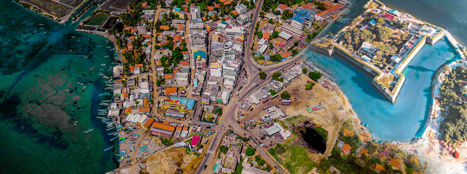
Mannar City
Mannar is the main town of Mannar District, Northern Province, Sri Lanka. It is governed by an Urban Council. The town is located on Mannar Island overlooking the Gulf of Mannar and is home to the historic Ketheeswaram temple.
Mannar-Strand
Mannar Beach an der Nordwestküste Sri Lankas ist bekannt für seine unberührte Schönheit, die weitläufigen Sandstrände und die ruhige Atmosphäre. Dieser Strand bietet ein einzigartiges und abgelegenes Küstenerlebnis – ideal für Reisende, die den überfüllten Touristenattraktionen entfliehen und in die Schönheit der Natur eintauchen möchten.
Abgeschieden und ruhig
Mannar Beach bietet lange Abschnitte unberührten goldenen Sandes und klares, ruhiges Wasser. Die abgelegene Lage des Strandes sorgt für eine friedliche Atmosphäre – perfekt für alle, die Einsamkeit und Entspannung abseits der Touristenströme suchen.
Angeln und lokale Kultur
Die Fischerei ist ein wesentlicher Bestandteil des Lebens in Mannar, und Besucher können den einheimischen Fischern bei der Arbeit mit traditionellen Methoden zusehen. Die Region ist reich an lokaler Kultur und bietet die Möglichkeit, den Alltag und die Bräuche der Küstengemeinden kennenzulernen.
Historische und kulturelle Stätten
Die nahegelegene Stadt Mannar bietet mehrere historische und kulturelle Sehenswürdigkeiten:
- Mannar Fort: Dieses im 17. Jahrhundert von den Portugiesen erbaute und später von den Niederländern erweiterte Fort bietet Einblicke in die koloniale Vergangenheit der Region und einen Panoramablick auf die Umgebung.
- Baobab-Baum: Ein ungewöhnlicher und beeindruckender Baobab-Baum in der Region Mannar , einer der wenigen seiner Art in Sri Lanka. Dieser Baum ist zu einem lokalen Wahrzeichen geworden und bietet eine einzigartige Fotogelegenheit.
- Adamsbrücke (Ramabrücke): Obwohl sie nicht direkt am Strand liegt, ist die nahe gelegene Adamsbrücke eine historisch interessante Stätte. Es handelt sich vermutlich um eine Kette von Kalksteinbänken, die einst Sri Lanka mit Indien verbanden.
Wildtier- und Vogelbeobachtung
Die Region um Mannar Beach ist für ihre vielfältige Vogelwelt bekannt. Vogelbeobachter können hier eine Vielzahl von Arten beobachten, darunter auch Zugvögel, die das Gebiet zu bestimmten Jahreszeiten besuchen. Auch die nahegelegene Insel Mannar ist für ihre Tierwelt und ihre natürliche Schönheit bekannt.
Lokale Küche
In Mannar können Besucher traditionelle sri-lankische Küche mit Schwerpunkt auf frischen Meeresfrüchten genießen. Lokale Gerichte wie Fischcurry, Krabbencurry und Garnelengerichte sind in den örtlichen Restaurants weit verbreitet und bieten einen Vorgeschmack auf das kulinarische Erbe der Region.
Unterkunft
Die Unterkunftsmöglichkeiten in Mannar sind im Vergleich zu touristisch erschlossenen Gebieten relativ bescheiden. Besucher finden eine Reihe von Pensionen und kleinen Hotels, die grundlegende Annehmlichkeiten und einen komfortablen Aufenthalt bieten. Viele dieser Unterkünfte bieten einfachen Zugang zum Strand und zu lokalen Sehenswürdigkeiten.
Beste Reisezeit:
Die beste Zeit für einen Besuch des Mannar Beach ist von November bis April , wenn das Wetter trocken und sonnig ist und ideale Bedingungen für Strandaktivitäten und die Erkundung der Umgebung bietet. Die Monsunzeit beginnt normalerweise im Mai und bringt Regen und rauere See mit sich.
About Mannar District
Mannar is the capital of Mannar District, Sri Lanka. Mannar District is located in northwestern Sri Lanka. It is one of five administrative districts of the Northern Province. The district covers 2,002 sq. km, approximately 3% of the total land area of Sri Lanka. Geographically the bulk of Mannar is on the mainland within the arid and dry zone. High temperatures and low rainfall characterize the climate. The monthly temperatures range between 26.5°C and 30.0°C with highs normally recorded between May and August. Mannar receives nearly 60% of its rainfall during the northeast monsoon, which lasts from October through December. The land area is relatively flat and sits at low elevations. Towards the interior the terrain is gently undulating, favoring the storage of rainwater in tanks that provide the majority of the irrigation for the district's arable land. The primary economic activities in Mannar are crop cultivation (mainly paddy), fisheries and animal husbandry. Employment opportunities in the district are highly seasonal, and there are no institutional facilities for tertiary education.
About Northern Province
The Northern Province is one of the 9 provinces of Sri Lanka. The provinces have existed since the 19th century but they didn't have any legal status until 1987 when the 13th Amendment to the 1978 Constitution of Sri Lanka established provincial councils. Between 1988 and 2006 the province was temporarily merged with the Eastern Province to form the North-East Province. The capital of the province is Jaffna.
Northern Province is located in the north of Sri Lanka and is just 22 miles (35 km) from India. The province is surrounded by the Gulf of Mannar and Palk Bay to the west, Palk Strait to the north, the Bay of Bengal to the east, and the Eastern, North Central and North Western provinces to the south. The province has a number of lagoons, the largest being Jaffna Lagoon, Nanthi Kadal, Chundikkulam Lagoon, Vadamarachchi Lagoon, Uppu Aru Lagoon, Kokkilai lagoon, Nai Aru Lagoon, and Chalai Lagoon.Most of the islands around Sri Lanka are to be found to the west of the Northern Province. The largest islands are Kayts, Neduntivu, Karaitivu, Pungudutivu, and Mandativu.
The Northern Province's population was 1,311,776 in 2007. The majority of the populations are Sri Lankan Tamils, with a minority Sri Lankan Moor and Sinhalese population. Sri Lankan Tamil is the major language spoken in the province by the vast majority of the population. The other language spoken is Sinhala by 1 percent of the population. English is widely spoken and understood in the cities.
【Text by Lakpura™. Images by Google, copyright(s) reserved by original authors.】