Mannar-Stadt
Lage: Mannar liegt 325 km nördlich von Colombo
MannarDie reguläre Route von Colombo nach Mannar führt über Anuradhapura und Madawachchiya .
Distrikt Mannar
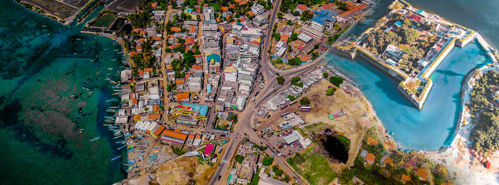
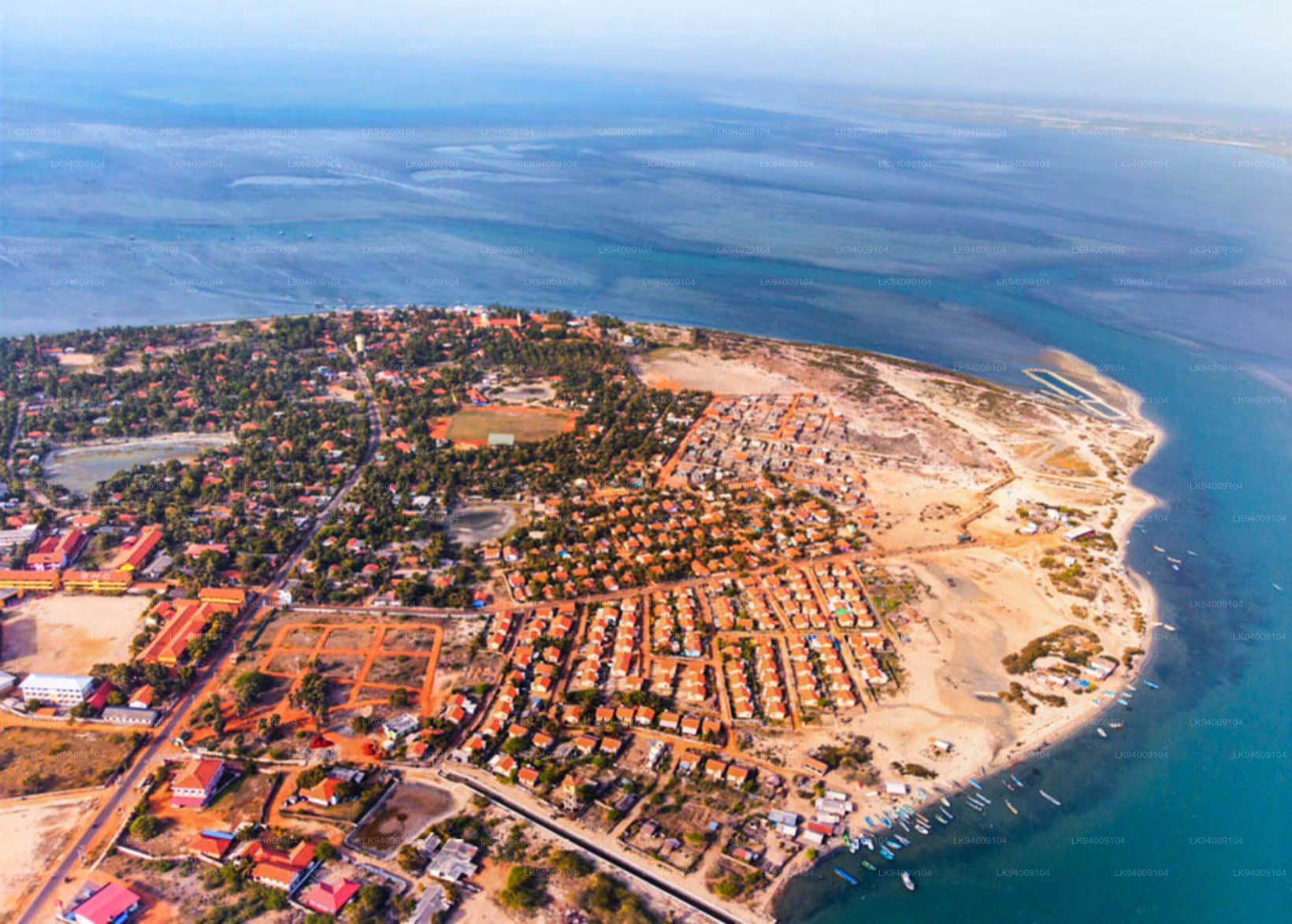
Der Distrikt Mannar gehört zur Nordprovinz Sri Lankas und besteht aus einem Teil des Festlands und der Insel Mannar – der größten Insel des Landes. Die Straße nach Mannar führt durch die Trockenzone Sri Lankas. Die Landschaft im Distrikt Mannar variiert von bewaldeten Dschungeln über Reisfelder bis hin zu sich wiegenden Palmen.
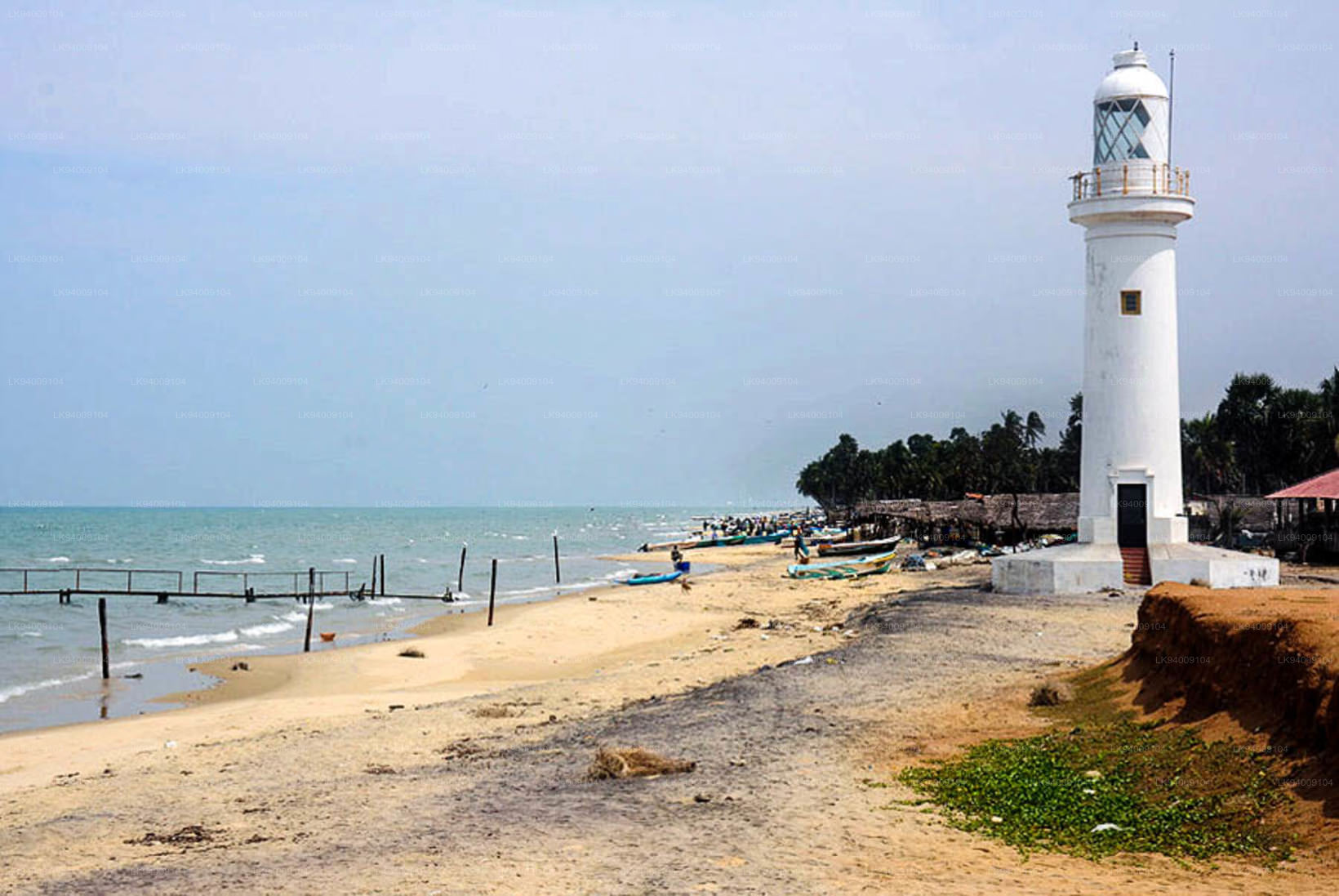
Mannar Island
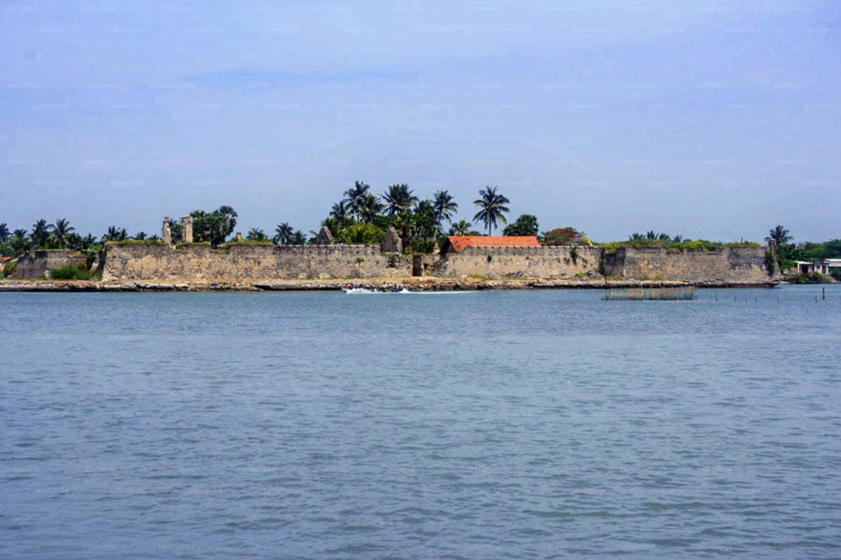
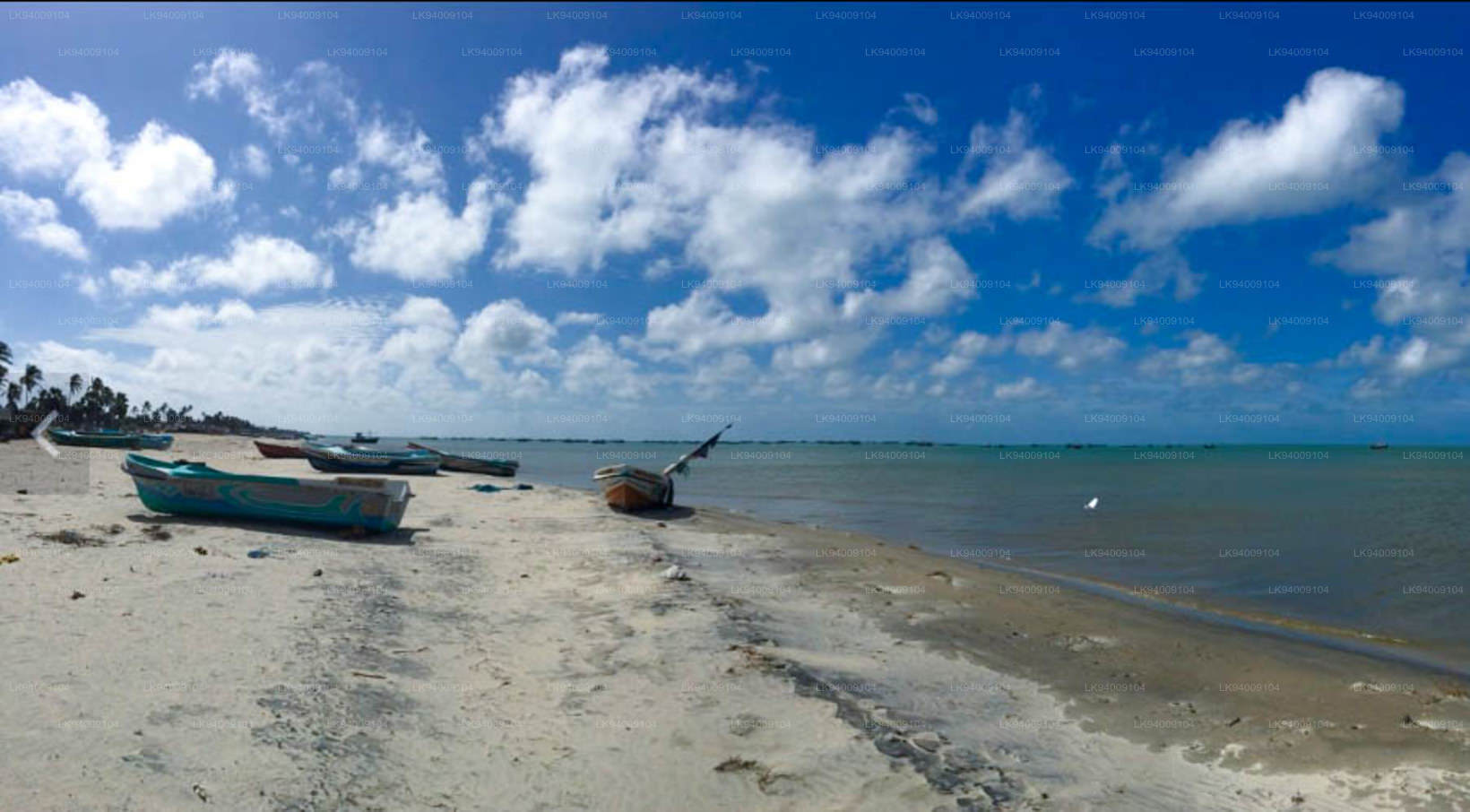
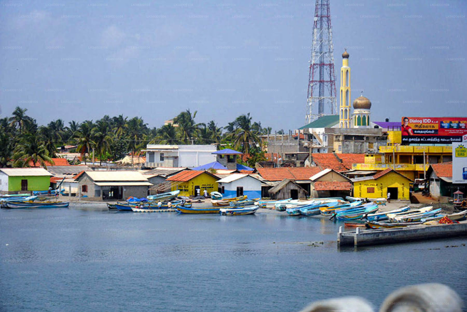
Mannar Island ist eine trockene und karge Halbinsel im Distrikt Mannar . Obwohl sie als Inselchen bezeichnet wird, handelt es sich tatsächlich um eine Halbinsel in Form einer Zunge. Talaimannar, die westlichste Spitze der Insel, ist durch ein Korallenriff in der Palkstraße fast mit Dhanuskodi, der östlichsten Spitze der Halbinsel Südindien, verbunden.
Abgesehen von dem schmalen Landstreifen, der die Halbinsel mit dem Festland verbindet, ist die Insel Mannar auch durch einen Damm über das flache Wasser verbunden, der einen 3 km langen Abschnitt der Hauptstraße A14 Madawachchiya – Talaimannar bildet. Der kleine Fischerhafen von Mannar liegt an der Südostküste der Insel.
Die Insel Mannar wurde in der Vergangenheit mit Namen wie „Manthei“, „Mathota“, „Maathiththa“, „Mahaputu“ und „Mawatuthota“ bezeichnet.
Mannar Highlights
St. Mary's Kirche in Madhu
Die St. Mary's Church in Madhu (Heiligtum Unserer Lieben Frau von Madhu) liegt 50 km südöstlich von Mannar. Von der Kreuzung Madhu Road aus sind es 12 km Fahrt (A 378 Madhu Road) landeinwärts von der Hauptstraße A14 Madawachchiya – Talaimannar.
Die im portugiesischen Stil erbaute Kirche aus dem 19. Jahrhundert beherbergt die Statue Unserer Lieben Frau von Madhu, die allen Besuchern Segen bringen soll. Die Statue wurde 1670 von Katholiken nach Madhu gebracht, die vor der Verfolgung durch die Holländer flohen. Das abgelegene Dorf Madhu ist seit über 1860 Jahren auch für Buddhisten heilig, nämlich seit der Zeit von König Gaja Bahu I. (114–136 n. Chr.), der den hinduistischen Pattini-Kult im alten Lanka einführte.
Es ist bemerkenswert, dass der Pattini-Kult nicht in Anuradhapura, der damaligen Hauptstadt und einem ruhmreichen asiatischen akademischen Zentrum des Theravada-Buddhismus, beheimatet war. Der Pattini-Devale-Schrein wurde in Mannar, 90 km nordwestlich von Anuradhapura, errichtet. Während der portugiesischen Herrschaft in Sri Lanka nannten ihn die Hindus Amman Kovil. Der nahegelegene Tank heißt noch heute Kovil Kulam (Tank des Devale), was sich vom tamilischen Namen des Ortes ableitet.
Die Pilger, die Madhu häufig besuchen, kommen hauptsächlich im Glauben an die Heilkräfte der Gottheit Pattini Amma. Auch kinderlose Frauen suchen Pattini Ammas Segen. Mr. EB Denham, der Autor des Zensusberichts von 1911, sagt: „Es handelt sich im Wesentlichen um eine Pilgerfahrt in den Wald. Der Erde von Madhu werden besondere medizinische Eigenschaften zugeschrieben, daher die Heiligkeit, die zu dem Ruf führte, dass die ‚Madhu-Medizin‘ in manchen Fällen Heilung bewirkt. Interessanterweise gab es im Jahr 1911 keine ständigen Bewohner von Madhu. Am 10. März 1911, dem Zensustag, waren nur 320 Pilger in Madhu anwesend, darunter 230 Singhalesen aus Colombo und dem Distrikt Chilaw.“
In seinem Handbuch der Nordzentralprovinz hielt der britische Beamte RW Levers Folgendes fest: „Heutzutage werden die Opfergaben im Allgemeinen zur St. Mary‘s Church in Madhu gebracht, die von den Buddhisten und vielen tamilischen Pilgern, die dorthin kommen, als Tempel von Pattini Amma (Amman Kovil) angesehen wird.“
Mit dem Bau einer Kirche ab 1876 griff der katholische Bischof von Jaffna den jahrhundertealten Glauben an die Heilkräfte von Pattini Amma auf und würdigte damit die Jungfrau Maria des christlichen Glaubens. Für Buddhisten und Hindus ist der Ort jedoch nach wie vor heilig.
Madhu-Fest
Das Madhu-Fest findet Mitte August statt. Am 15. August, dem Tag der Himmelfahrt der Heiligen Jungfrau Maria, werden voraussichtlich über eine halbe Million Gläubige aus ganz Sri Lanka kommen. Am Tag der Himmelfahrt der Heiligen Jungfrau Maria feiert die römisch-katholische Kirche den Tag, an dem die Jungfrau Maria nach Abschluss ihres irdischen Lebens mit Leib und Seele in den Himmel aufgenommen wurde.