

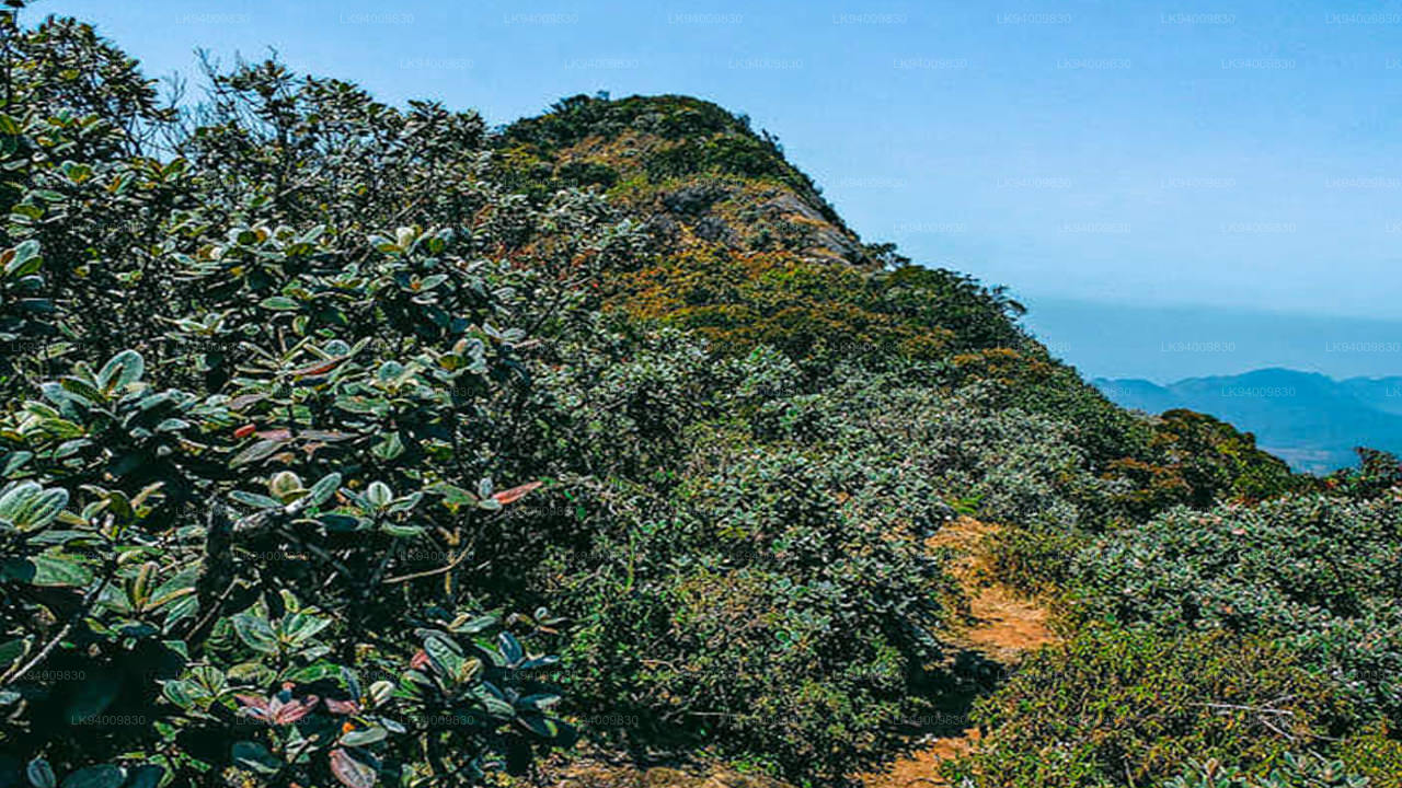
Kirigalpotta
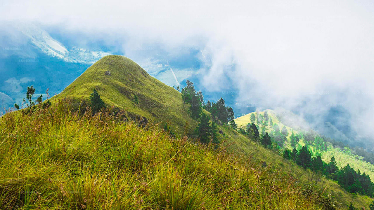
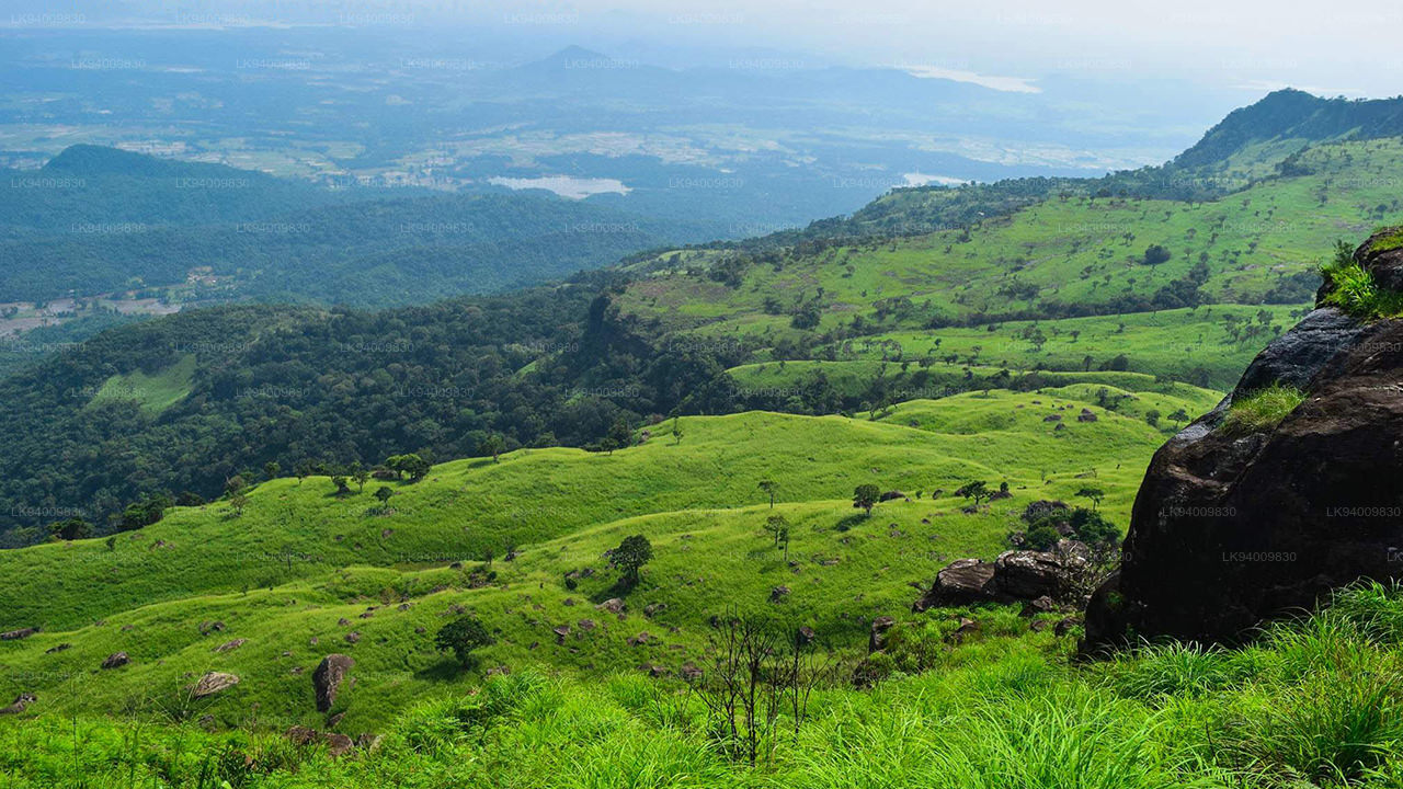
Der Berg Kirigalpoththa in Sri Lanka – der zweithöchste Berg der Insel. Mit einer Höhe von 2388 m (7835 Fuß) über dem Meeresspiegel erhebt sich der Berg Kirigalpoththa in Sri Lanka im Bezirk Nuwara Eliya und wirft seinen Schatten auf die Hauptstadt. Der Name Kirigalpoththa bedeutet wörtlich übersetzt „Milch(baum)rindenfelsen“ (Kiri – Milch, Gal – Fels und Poththa – Baumrinde), möglicherweise weil der Berg viele hohe Bäume mit weiß gesprenkelter Rinde hat. Erreichbar über einen Naturlehrpfad im Horton-Plains-Nationalpark ist dieser Berg der zweithöchste im Inselparadies Sri Lanka und der höchste Berg der Insel, dessen Gipfel für die Öffentlichkeit zugänglich sind.
Berg Kirigalpoththa in Sri Lanka: Einige Dinge, die Sie wissen sollten
- Standort: Bezirk Nuwara Eliya
- Nächstes Dorf: Pattipola
- Nächste Stadt: Nanuoya
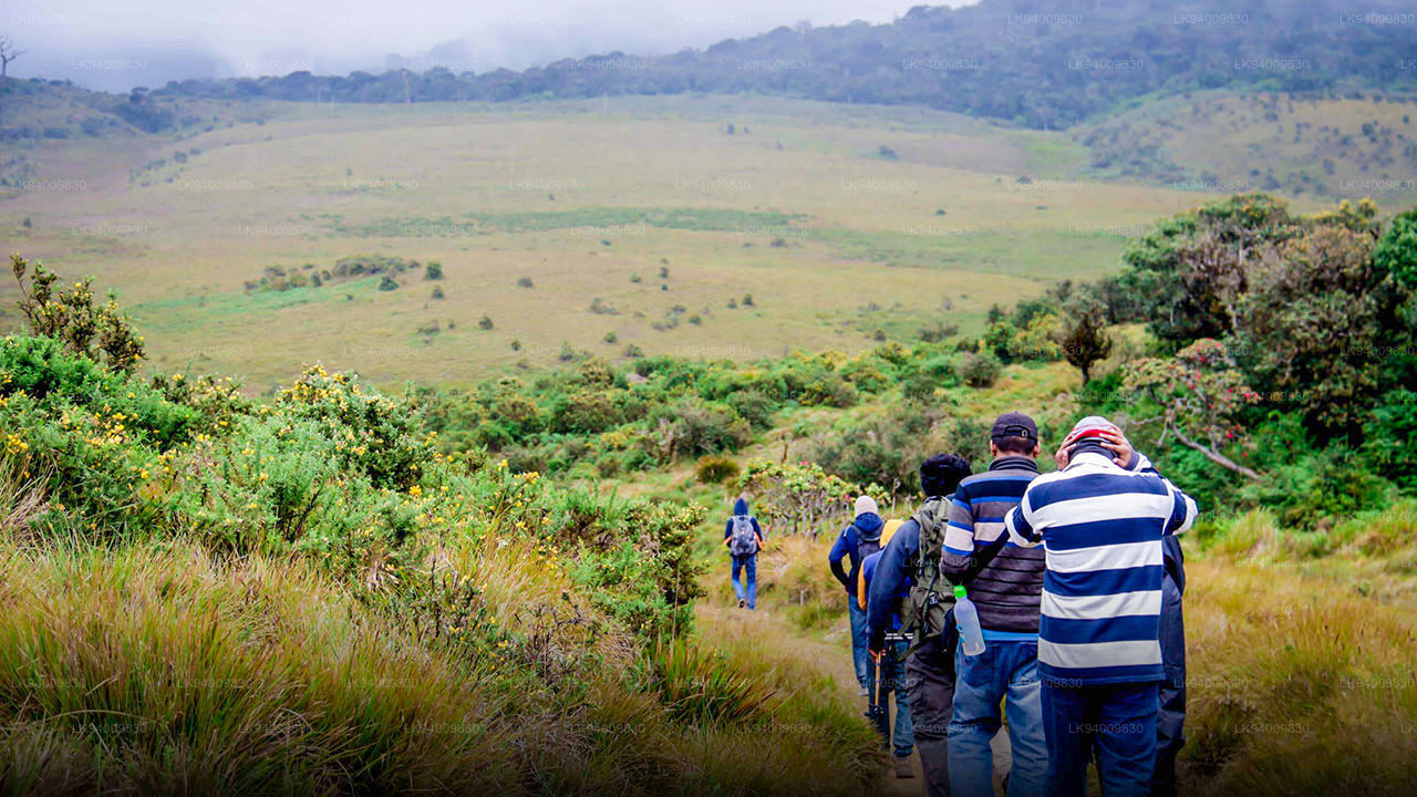
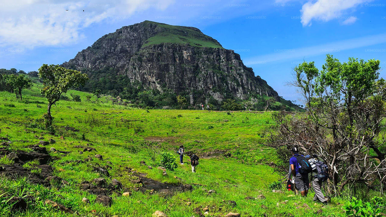
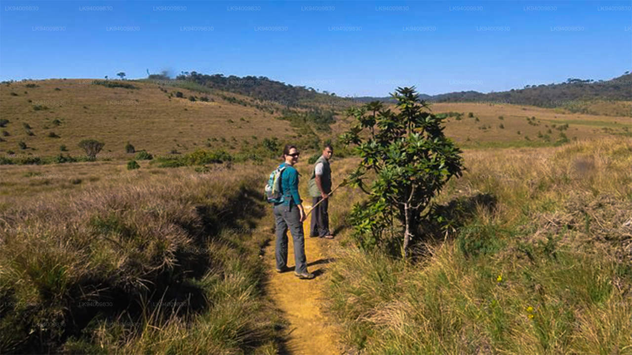
- Der Weg zum Aufstieg auf Kirigalpoththa befindet sich im Horton Plains National Park
- Ausgangspunkt des Wanderwegs: Besucherzentrum Horton Plains
- Ende des Weges: Kirigalpoththa-Gipfel
- Länge der Strecke: 5,6 km
- Höhenunterschied: 252 m (Höhe am Anfang des Weges: 2139 m – Höhe am Ende des Weges: 2392 m)
- Schwierigkeitsgrad des Aufstiegs: Mittel
- Kletterzeit: 3 – 4 Stunden
- Wetterbedingungen: In der Gegend von Nuwara Eliya ist es im Allgemeinen kalt und regnerisch. In den Monsunmonaten ist dies jedoch noch stärker der Fall. Die vergleichsweise trockensten Monate sind Februar bis April und Juli bis September . Weiter oben auf dem Weg sind starker Wind und kaltes Wetter fast garantiert.
- Genehmigung erforderlich: Ja. Kann am Eingang des Hortons Plains National Park eingeholt werden
- Was Sie zum Klettern mitnehmen sollten: Wasserflasche, leichter Pullover, Regenjacke, Insektenspray und Salz gegen Blutegel, Erste-Hilfe-Ausrüstung wie Pflaster, Desinfektionsmittel und Verbandsmaterial. (Ein starkes Kletterseil kann ebenfalls von Vorteil sein.)
- Zu tragende Kleidung: Dicke Kleidung, die Ihre Haut vor Brombeeren und Ähnlichem schützt, und hohe rutschfeste Stiefel, um ein Ausrutschen im Schlamm zu vermeiden.
- Weitere Tipps: Verlassen Sie nicht den markierten Weg, da die Ebene sumpfig ist. Versuchen Sie nicht, alleine zu klettern.
-
 Kirigalpotta
Mit einer Höhe von bis zu 2388 Metern über dem Meeresspiegel erhebt sich der Kirigalpoththa-Berg in Sri Lanka im Distrikt Nuwara Eliya und wirft seinen Schatten über die Hauptstadt. Er ist der zweithöchste Berg des Inselparadieses Sri Lanka und der höchste Berg der Insel.
-
 Thotupola Kanda
Der Totapolakanda ist mit 2.357 m über dem Meeresspiegel der dritthöchste Berg Sri Lankas und liegt im Distrikt Nuwara Eliya. Er befindet sich im Horton-Plains-Nationalpark. Ein etwa zwei Kilometer langer Wanderweg zum Gipfel beginnt nur wenige Meter vom Pattipola-Eingang des Nationalparks entfernt.
-
 Adam’s Peak (Berg Sri Pada)
Das bekannteste Naturmerkmal Ceylons ist der Adam’s Peak im Distrikt Ratnapura. Er liegt am Rande des zentralen Bergmassivs, umgeben von der Berggruppe „Wilderness of the Peak“. Mit einer Höhe von etwa 2286 Metern ist er der zweithöchste Berg des Landes.
-
 Hakgala-Gipfel
Der Hakgala-Gipfel liegt im zentralen Hochland Sri Lankas, innerhalb des strengen Naturschutzgebiets Hakgala. Er befindet sich in der Nähe der Stadt Nuwara Eliya und ist Teil der Region des zentralen Hochlands, die für ihre atemberaubenden Landschaften und ihr kühleres Klima bekannt ist.
-
 Gommolliya
Der Gommolliya-Gipfel ist Teil des Knuckles-Gebirges im Zentrum Sri Lankas, einem UNESCO-Welterbe, das für seine Artenvielfalt und landschaftliche Schönheit bekannt ist. Der Gipfel liegt im Distrikt Kandy im zentralen Hochland Sri Lankas.
-
 Bambarakanda-Gipfel
Der Bambarakanda-Gipfel liegt im Distrikt Badulla in der Provinz Uva auf Sri Lanka. Er gehört zum zentralen Hochland und befindet sich in der Nähe der berühmten Bambarakanda-Wasserfälle, dem höchsten Wasserfall Sri Lankas. Die Gegend ist bekannt für ihre üppige Vegetation, ihr kühles Klima und ihre atemberaubende Naturschönheit.
-
 Riverston Peak
Der Riverston Peak in Sri Lanka ist über die Straße Matale–Girandurukotte zu erreichen, die etwa 30 km von der Stadt Matale entfernt liegt. Diese kurvenreiche Straße mit ihren scharfen Serpentinen bietet atemberaubende Ausblicke auf die umliegende Landschaft und wird daher auch als „Mini-Weltende“ bezeichnet.


