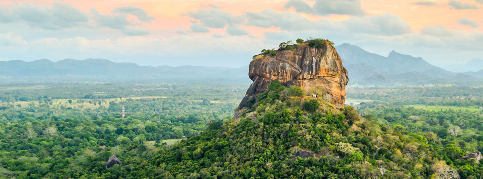
Sigiriya, památka UNESCO na Srí Lance, je starobylá skalní pevnost a palác s úchvatnými freskami a rozsáhlými zahradami. Dramaticky se tyčí z rovin a je důkazem bohaté historie a architektonické vynalézavosti ostrova. Prozkoumejte okouzlující krásu a kulturní význam Sigiriyi.
Sigiriya Reservoir, located near the iconic Sigiriya Rock Fortress, plays a significant role in Sri Lanka’s ancient hydraulic system and offers tourists a unique experience of both nature and history. This man-made reservoir was originally constructed during the reign of King Kashyapa in the 5th century and served as an essential part of the advanced water management system that supported the Sigiriya kingdom.
Tourists visiting the Sigiriya Reservoir can experience the serene beauty of the water body surrounded by lush greenery and scenic landscapes. The reservoir is especially beautiful during early morning and late afternoon, making it an ideal spot for photography enthusiasts looking to capture the reflection of Sigiriya Rock on the calm waters. This stunning backdrop creates an almost mirror-like effect, enhancing the natural beauty of the area.
The reservoir also offers boat rides, allowing visitors to appreciate the engineering marvel of this ancient structure while enjoying peaceful moments on the water. The boat ride provides panoramic views of the surrounding forests, distant mountains, and the towering Sigiriya Rock, giving tourists a unique perspective on the area’s historical and ecological importance.
Wildlife enthusiasts will appreciate the variety of bird species that can be observed around the reservoir. The water body attracts various aquatic birds, including herons, kingfishers, and egrets, making it a great location for birdwatching. The reservoir is also home to fish and other aquatic life, contributing to its biodiversity.
Additionally, the area around the reservoir offers opportunities for walking and nature trails, where tourists can explore the natural flora and fauna of the region. The combination of history, nature, and wildlife makes a visit to Sigiriya Reservoir a memorable experience, offering a tranquil escape that complements the grandeur of Sigiriya Rock.
Die Zentralprovinz Sri Lankas besteht hauptsächlich aus bergigem Gelände. Die Provinz hat eine Fläche von 5.674 km² und 2.421.148 Einwohner. Zu den größeren Städten gehören Kandy, Gampola (24.730), Nuwara Eliya und Bandarawela. Die Bevölkerung ist eine Mischung aus Singhalesen, Tamilen und Mauren. Sowohl die Berghauptstadt Kandy als auch die Stadt Nuwara Eliya liegen in der Zentralprovinz, ebenso wie Sri Pada. Die Provinz produziert einen Großteil des berühmten Ceylon-Tees, der in den 1860er Jahren von den Briten angebaut wurde, nachdem eine verheerende Krankheit alle Kaffeeplantagen der Provinz vernichtet hatte. Die Zentralprovinz zieht mit ihren Bergstädten wie Kandy, Gampola, Hatton und Nuwara Eliya viele Touristen an. Der Zahntempel oder Dalada Maligawa ist die wichtigste heilige Stätte in der Zentralprovinz. Das Klima ist kühl und in vielen Gebieten auf über 1.500 Metern Höhe sind die Nächte oft frostig. Die Westhänge sind sehr feucht; an manchen Orten fallen fast 7000 mm Niederschlag pro Jahr. Die Osthänge gehören zur mitteltrockenen Zone, da sie nur vom Nordostmonsun beregnet werden. Die Temperaturen reichen von 24 °C in Kandy bis zu nur 16 °C in Nuwara Eliya, das 1889 m über dem Meeresspiegel liegt. Die höchsten Berge Sri Lankas befinden sich in der Zentralprovinz. Das Gelände ist überwiegend gebirgig und von tiefen Tälern durchzogen. Die beiden wichtigsten Gebirgsregionen sind das Zentralmassiv und die Knuckles-Kette östlich von Kandy.