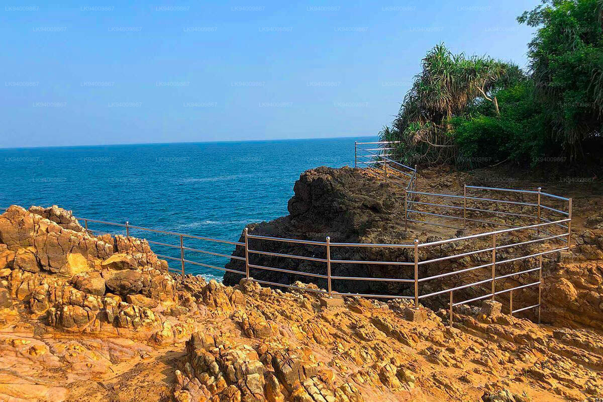
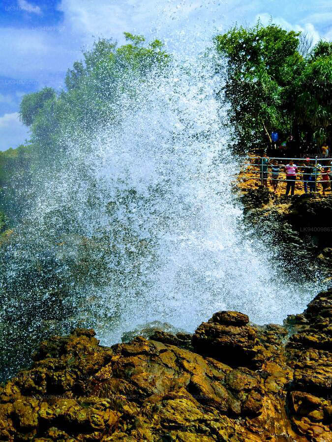
Hummanaya Blow Hole


Ein Blowhole ist eine geologische Erscheinung, die man manchmal entlang von Küstenregionen findet. Das Phänomen tritt auf, wenn die Flut Unterwasserhöhlen mit Meerwasser füllt. Die Höhlen entstehen durch einen geologischen Prozess der Küstenerosion. Dies kann durch „hydraulische Einwirkung“ geschehen, bei der die Wellen Druck auf die Luftlöcher in den kleinen Rissen in der Klippe ausüben und diese dadurch weiter aufweiten; durch „Abrasion“ oder „Korrosion“, wenn die Wellen Steine, Kiesel, Sand und anderes Material in die Klippe schlagen; durch chemische Verwitterung, die durch den Säuregehalt des Meerwassers verursacht wird, der besonders schädlich für Gesteinszusammensetzungen wie Kalkstein ist; und durch „Attrition“, einen Schmirgeleffekt, der durch kleine lose, runde Gesteinsbrocken verursacht wird. Wenn die Höhlen eine oberirdische Öffnung haben, bewirkt der Druck, dass das Wasser regelmäßig in einer Fontäne oder „Blase“ herausgedrückt wird. Zeitpunkt und Höhe der Wasserfontänen aus diesen Blowholes hängen von den Gezeiten und Wellenformationen ab.
Während es auf der ganzen Welt und insbesondere entlang der europäischen Küste viele Blowholes gibt, ist in Sri Lanka nur ein einziges bekannt. Es liegt in der Nähe von Kudawella, einem kleinen Fischerdorf in der Südprovinz . Hummanaya kann über einen Tombolo erreicht werden, ein Stück Land, das durch die Ablagerung von Sand oder Kies entsteht und eine Insel mit dem Festland verbindet. Dieses Blowhole ist unter den Besuchern der Insel berühmt, da es als das zweitgrößte Blowhole der Welt gilt. Benannt nach dem lauten Summen, das es erzeugt, wenn es aktiv ist; das Hummanaya Blowhole kann eine Höhe von 25 bis 30 m erreichen.